
Maryland Map
|
 |
 |
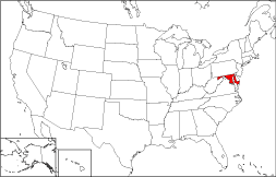
Where Is Maryland?
On the 50 state map to the right, the location of Maryland is shown in red. The State of Maryland is bounded by Pennsylvania on the north, by Virginia on the south, by Delaware on the east, and by West Virginia on the west. The nation's capital, Washington, DC, lies to the south of Maryland. It is bounded by the Atlantic Ocean on the southeast.
Maryland Maps
Maryland is the 42nd largest state in the United States, and its land area is 9,774 square miles (25,315 square kilometers). Maryland is partitioned into 23 counties plus the city of Baltimore, which forms its own administrative division. This Maryland map site features road maps, topographical maps, and relief maps of Maryland. The detailed, scrollable road map displays Maryland counties, cities, and towns as well as Interstate, U.S., and Maryland state highways. The pannable, scalable Maryland street map can be zoomed in to show local streets and detailed imagery.
Maryland Highway Map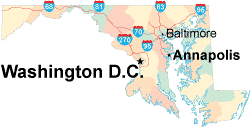 Click on the highway map thumbnail
to view a scalable Maryland road map. |
MD Topo Map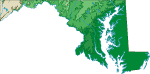 Click map to enlarge.
|
MD Relief Map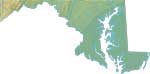 Click map to enlarge.
|
The detailed Maryland map and the regional Maryland map display cities, roads, rivers, and lakes as well as terrain features. The detailed map shows only the State of Maryland, while the regional map shows Maryland and the surrounding region.
Maryland Infrastructure > Maryland Airports
In 2005, the population of Maryland was estimated at 5,589,599, which is about 573.0 people per square mile. In 2010, Maryland's population rose to 5,773,552 people. More recently, in the 2020 census, the Maryland population was 6,177,224. The state's primary Interstate Highways include I-68, I-70, I-83, and I-95.
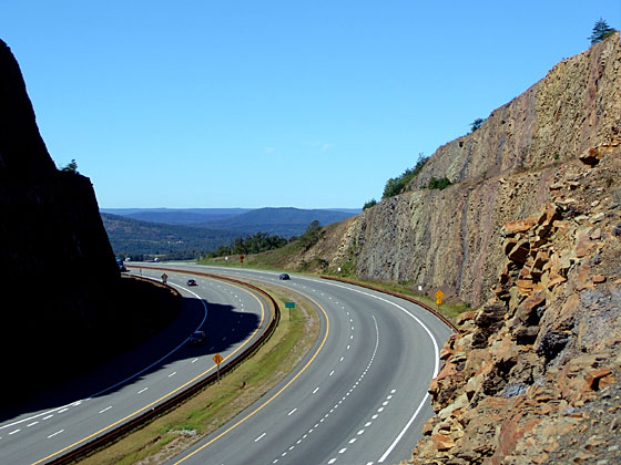 Interstate Highway 68 on Sideling Hill in Western Maryland
Maryland Topography and Tourist Attractions
Maryland was named in honor of Henrietta Maria, the queen of English king Charles I. Eastern Maryland surrounds the Chesapeake Bay and its coastal marshlands, while the Allegheny Mountains rise in the western half of the state. Popular tourist attractions include the Atlantic Ocean beaches along the eastern shore as well as the Goddard Space Flight Center, Harper's Ferry National Park, and Antietam National Battlefield. For additional Maryland travel and tourism information, visit the official Maryland tourism site and Maryland Atlas.
Other Maryland Maps
This online Maryland reference map shows major cities, roads, railroads, and physical features in Maryland.Several map publishing companies offer printed maps of Maryland. For example, Omni Resources offers several maps of Maryland that feature points of interest, airports, and parks, as well as selected local attractions and insets of major Maryland cities.
All rights reserved.
Certain maps hereon are © Map Resources or Digital Wisdom.
To facilitate browsing, certain external links will open in new windows.
Maryland-Map.org Editor, State Maps, PO Box 828, Barnegat, NJ 08005.